

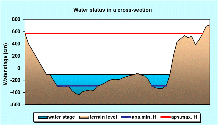
Reporting surface water station: VARVARIN
Choose name of station for more information.| Station: | VARVARIN | ||
|---|---|---|---|
| River: | VELIKA MORAVA | ||
| Basin: | DUNAV | ||
| Foundation year: | 1924 | ||
| KOTA "0" (m n.J.m.): | 126.13 | ||
| Distance from the river mouth (km): | 177.220 | ||
| Basin area (km2): | 31548 | ||
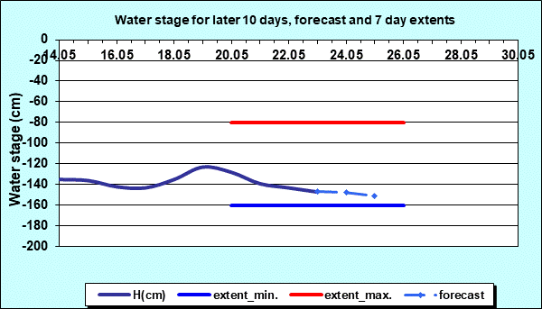
| Date: SATURDAY, 23.05.2026. | |||
| Water stage (cm) |
Change of water stage (cm) |
River flow (m3/s) |
Water temperature (оC) |
| 133 |
|||
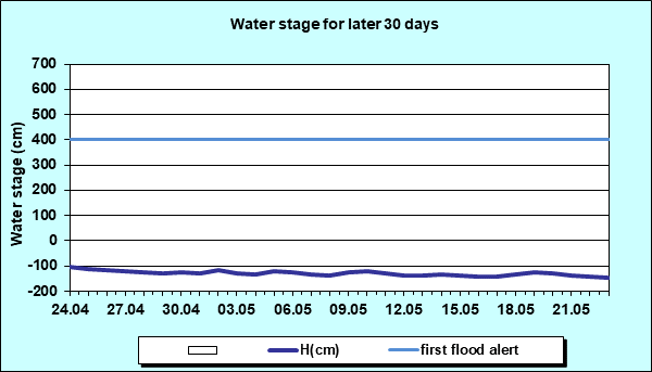
| Tendency | Ice events | First flood alert (cm) |
Second flood alert (cm) |
 |
- | 400 | 500 |
| Water stage forecast | Weekly range | ||||
|---|---|---|---|---|---|
| Day: | SUNDAY | MONDAY | TUESDAY | WEDNESDAY | WEDNESDAY ÷ TUESDAY |
| Date: | 24.05. | 25.05. | 26.05. | 27.05. | 20.05. ÷ 26.05. |
| Water stage (cm): | -148 | -151 | - | - | -160 ÷ -80 |
Diagrams


|
|
|
 Page print Page print |
| © 2026 Copyright RHMS of Serbia |