

Reporting surface water station: RAŠKA
Choose name of station for more information.| Station: | RAŠKA | ||
|---|---|---|---|
| River: | IBAR | ||
| Basin: | ZAPADNA MORAVA | ||
| Foundation year: | 1923 | ||
| KOTA "0" (m n.J.m.): | 392.54 | ||
| Distance from the river mouth (km): | 93.300 | ||
| Basin area (km2): | 6270 | ||
| Date: TUESDAY, 02.06.2026. | |||
| Water stage (cm) |
Change of water stage (cm) |
River flow (m3/s) |
Water temperature (оC) |
| 27.1 |
|||
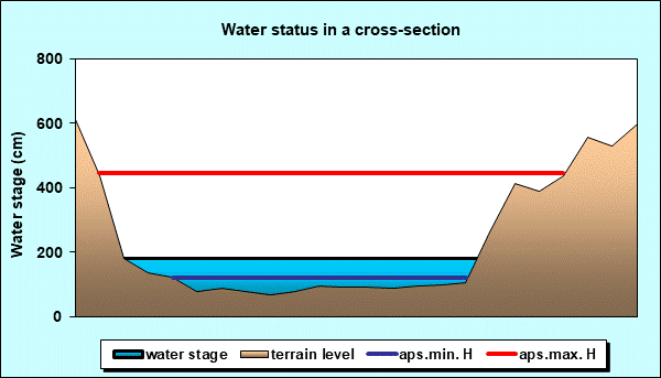
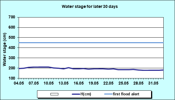
| Tendency | Ice events | First flood alert (cm) |
Second flood alert (cm) |
 |
- | 450 | 550 |
Diagrams


|
|
|
 Page print Page print |
| © 2026 Copyright RHMS of Serbia |